Overview of Hurricane Erin
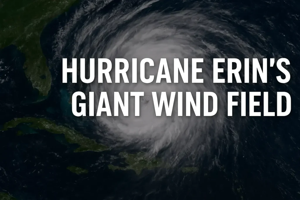
On Tuesday, August 19, 2025, Hurricane Erin continued its track through the Atlantic with maximum sustained winds near 115 mph (185 km/h). While the storm’s core winds are expected to weaken, its giant wind field is expanding, creating far-reaching impacts across the Caribbean, the U.S. East Coast, Bermuda, and Atlantic Canada.
Unlike compact hurricanes, Erin’s strength lies in its wide wind field and large swells, which will generate dangerous seas, storm surge, and coastal erosion even in areas far from the storm’s centre.
Hurricane Erin’s Current Track
- Pulling away from the Bahamas and Turks & Caicos
- Making a northward turn toward the Western Atlantic
- Expected to pass between Bermuda and the Outer Banks of North Carolina
- Tracking offshore of New England before curving toward the North Atlantic and Atlantic Canada
This trajectory keeps the storm’s core offshore but places coastal areas at risk from storm surge, gusty winds, and heavy seas.
Impacts on the Outer Banks & East Coast
Tropical Storm Watches and Warnings
- Outer Banks of North Carolina: Tropical storm force winds and surge risks are the primary concern.
- Storm Surge Forecast: 2–4 feet possible in low-lying areas such as Duck, Kitty Hawk, Nags Head, and Hatteras Island.
Key Coastal Concerns
- Beach erosion and flooding due to persistent onshore winds.
- Evacuations are underway in vulnerable zones where water rise is expected.
- Hazardous marine conditions with swells extending into the mid-Atlantic and New England.
New England & Atlantic Canada Outlook
- Cape Cod, Nantucket, and Martha’s Vineyard: Gusty winds up to 50 mph, dangerous seas, and possible backup of water in bays.
- Atlantic Canada (Newfoundland & Avalon Peninsula): We’re in monitoring mode. Strong winds are possible, but much of the rain stays offshore.
- New Brunswick, Nova Scotia, and Prince Edward Island: Dry conditions continue, as Erin’s rainfall remains displaced to the southeast.
Caribbean & Bermuda Conditions
- Bermuda: Core winds remain offshore, sparing the island from hurricane conditions.
- Caribbean Islands: Outer rainbands may brush parts of the Dominican Republic, Puerto Rico, and the Virgin Islands, though Erin is lifting north.
- Bahamas: Lingering showers from feeder bands, with seas remaining dangerous.
Erin’s Wind Field & Wave Heights
The most striking feature of Erin is its enormous wind field:
- Tropical storm-force winds: Extending hundreds of miles from the centre.
- Wave heights: Open waters seeing seas of 30–40+ feet (over 6–12 meters).
- Hazardous swells: Spreading from the Caribbean northward through the Western Atlantic.
Even though hurricane-force winds remain over open water, the expansive storm surge and wave action will have lasting effects on coastlines.
Monitoring New Tropical Waves
In addition to Hurricane Erin, two new tropical waves are being monitored:
- One moving through the eastern Caribbean near Dominica, Barbados, and St. Lucia.
- Another is just off the coast of Africa, where warm waters could allow gradual development.
Currently, both systems show limited short-term development, but heavy rain and flooding are possible in the Lesser Antilles and parts of the eastern Caribbean later this week.
If one of these tropical systems strengthens, the next name on the 2025 Atlantic hurricane list is Ferdinand.
Preparedness & Safety Tips
- Follow local evacuation orders in low-lying coastal areas.
- Avoid beach and boating activity due to life-threatening rip currents and large swells.
- Monitor official forecasts as Erin tracks offshore but still produces widespread impacts.
Final Thoughts
Hurricane Erin highlights the danger of large, sprawling wind fields, where impacts extend far beyond the storm’s centre. From the Outer Banks of North Carolina to Atlantic Canada, residents should remain alert for storm surge, high surf, and gusty winds.
At the same time, attention turns to the subsequent tropical waves emerging in the Atlantic, reminding us that August remains a peak month of hurricane season.