
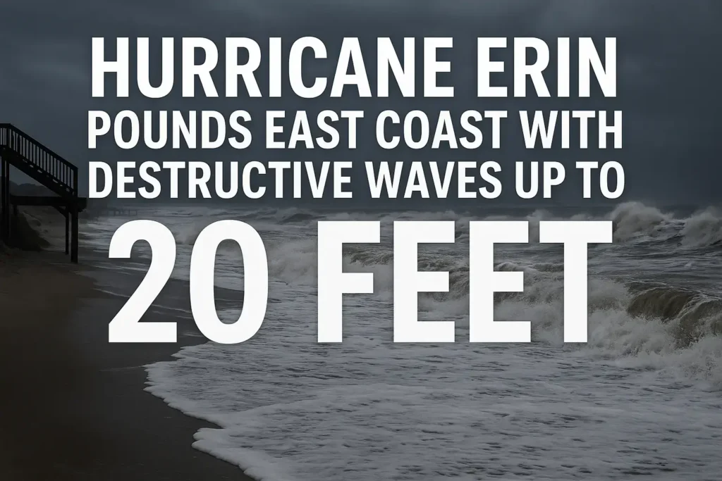
Hurricane Erin continues to make its presence felt along the East Coast, unleashing destructive waves of up to 20 feet along North Carolina’s Outer Banks. Conditions have shifted dramatically over the past 48 hours, with coastal communities bracing for flooding, beach erosion, and powerful winds.
The system, located just about 200 miles off Cape Hatteras, remains a powerful storm despite showing early signs of weakening. Its massive size means dangerous conditions extend far beyond the storm’s core, putting vulnerable areas along the shoreline at risk.
Although the hurricane is shifting offshore, its wide arms of strong winds continue to generate destructive surf, tidal flooding, and dangerous rip currents. Dry air has wrapped around the western side of the storm, reducing rainfall inland but leaving the coastline exposed to wave action and surge.
The Outer Banks of North Carolina are experiencing the brunt of Erin’s power:
Though the main hurricane core has stayed offshore, the 20-foot waves crashing into the coastline are causing beach erosion, dune loss, and structural concerns for low-lying properties.
As Hurricane Erin tracks northward, impacts spread beyond North Carolina:
The fortunate news is that tides are beginning to move out, reducing the risk of a major surge event. Still, forecasters warn of dangerous surf and coastal flooding continuing through the evening.
The system is expected to continue weakening gradually as it races northward, but the risks remain:
For now, the worst-case scenario of a direct landfall has been avoided. Still, Erin’s size proves that even an offshore hurricane can deliver serious threats to East Coast communities.
Hurricane Erin’s near-miss reminds us just how vulnerable the East Coast remains during peak hurricane season. With nearly 80% of the season still ahead, residents are urged to stay prepared, monitor forecasts, and respect coastal warnings.