
Hurricane Erin continues to churn offshore, maintaining its strength as a Category 2 hurricane with sustained winds of around 100 mph. While the storm is not expected to make direct landfall along the East Coast, its impacts are already being felt across coastal communities.
As of the latest advisory, tropical storm warnings have been extended northward to the Virginia–North Carolina border, signalling potential for strong winds, dangerous surf, and flooding in low-lying areas.
Even though Erin is offshore, its wide wind field is generating life-threatening surf and rip currents. Authorities strongly advise against swimming or entering the water, no matter how calm conditions may appear on land.
The combination of high tides, strong onshore winds, and heavy surf will lead to worsening conditions:
While the weather may appear sunny and calm inland, coastal areas are under serious threat. Here are the most important safety steps:
Hurricane Erin will remain offshore, but its expansive wind field and wave energy will continue to generate hazardous conditions along much of the East Coast. The storm serves as a reminder that a hurricane does not need to make landfall to have major impacts on coastal communities.
As warnings remain in effect and waters grow increasingly dangerous, residents and visitors alike are urged to stay safe, remain informed, and avoid unnecessary risks along the shorelines.
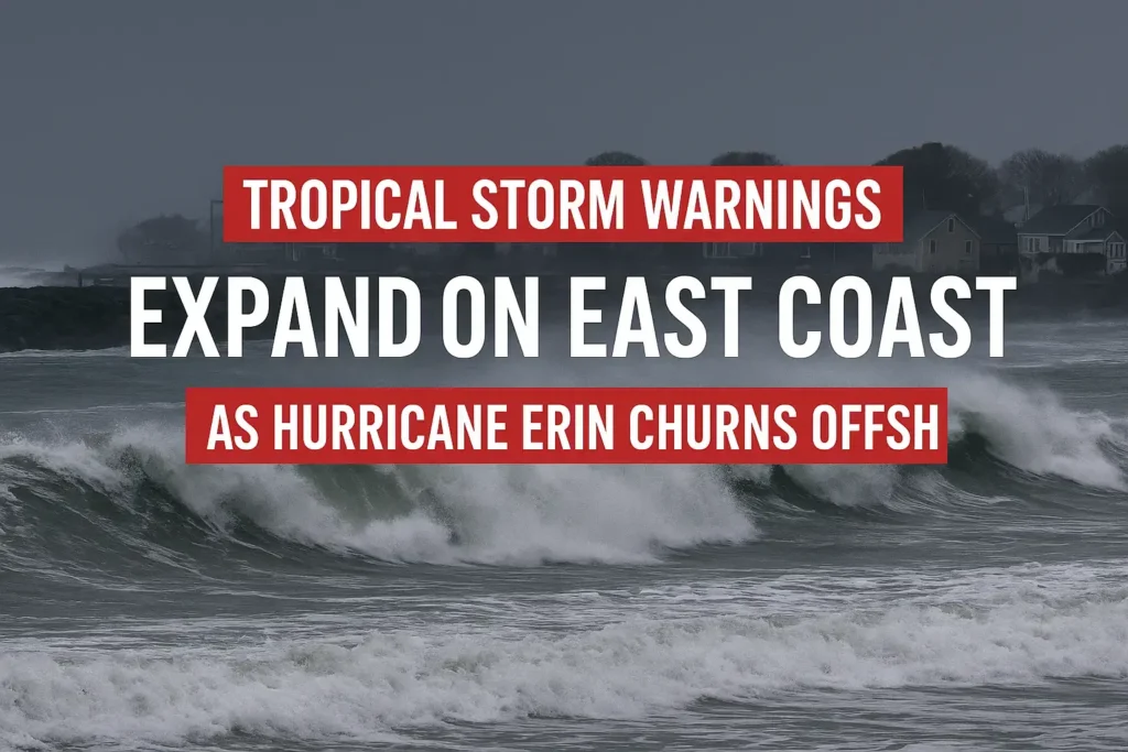
East Coast on Alert: Tropical Storm Warnings Issued as Hurricane Erin Churns Offshore
A Category 2 Hurricane, Erin is currently swirling in the western Atlantic, approximately 400 miles southeast of North Carolina’s Outer Banks. With sustained winds nearing 100 mph, it’s expected to remain off the coast throughout the weekend. Even though a direct U.S. landfall seems unlikely, Erin’s extensive reach—where tropical-storm-force winds stretch about 265 miles from its centre—is already creating perilous ocean conditions. Forecasters caution that life-threatening surf and rip currents will impact the Eastern Seaboard.
Tropical Storm Warnings Expand Northward
Coastal warnings have now been extended further up the coast. Tropical Storm Warnings now encompass all of North Carolina’s Outer Banks, stretching from Beaufort Inlet to the Virginia state line. Communities just beyond that line in southeastern Virginia are currently under a Tropical Storm Watch. These alerts signify that tropical-storm conditions—sustained winds of around 35–40 mph with gusts exceeding 40 mph—are forecasted for Wednesday night into Thursday. Moreover, heavy rainfall ranging from 1 to 4 inches is anticipated for the Outer Banks during this period.
Dangerous Surf, Rip Currents, and Coastal Flooding
High-risk rip currents: Coastal areas from Florida to New England are facing a significant risk of strong rip currents. Many beaches, such as those in New York City and parts of North Carolina, have enforced swimming bans. Lifeguards have already performed numerous rescues in recent days, reinforcing the need for caution. Beachgoers are strongly advised to avoid the water entirely while the storm remains nearby.
Intense waves and surf: Towering waves are expected to batter the shoreline. The Outer Banks should prepare for 15–25 foot breakers, along with a storm surge of 3–4 feet coinciding with high tide. Waves from Virginia to Maryland are likely to reach heights of 10–14 feet. Further north, in Delaware and New Jersey, surf heights of 8–11 feet and coastal flooding extending 1–2 feet may occur, particularly around Thursday’s high tide.
Erosion and flooding inland: The relentless surf will not only erode beaches but also push water into bays and inlets. For instance, water has already started to overtop portions of NC Highway 12, the main route in and out of the Outer Banks, during high tides. In the Mid-Atlantic region, up to 3 feet of extra water could flood parts of the Chesapeake Bay shoreline. Similarly, on the Delaware-New Jersey coast, expect 1–2 feet of inundation, potentially affecting bayfront roads and low-lying areas.
Safety Precautions and Beach Closures
Authorities are urging everyone to take proactive measures now. Avoid entering the ocean. A number of beaches from the Carolinas to New York have already closed their waters to swimming and are advising even the best swimmers to remain out of the surf. Emergency officials have begun opening shelters for residents mandated to evacuate the Outer Banks, with additional evacuation orders likely if conditions deteriorate.
Get ready: Residents along the coast should assemble emergency supplies and stay updated. Verify that your emergency kit—comprising food, water, flashlight, batteries, and more—is equipped, and ensure that your weather alerts are activated. Listen carefully for local announcements—especially any evacuation directives for barrier islands or low-lying locales—and adhere to official guidance. The National Hurricane Centre and local agencies will continue to provide updates regarding forecasts and warnings until the storm threat has subsided.
Key Takeaways: Tropical Storm Warnings now extend to the North Carolina–Virginia border as Hurricane Erin continues to churn offshore. Dangerous rip currents, monumental waves, and coastal flooding are forecasted across the entire East Coast through late this week. Beachgoers should remain out of the water, heed all safety warnings, and stay connected to official weather updates.